Get outdoors and discover Lake Macquarie's best walking tracks
Not many cities in the world are surrounded by so many picturesque walks than Lake Macquarie. From sweeping arcs of golden coast to the rolling green of mountain forests, Lake Macquarie is home to an incredible range of natural environments.
This diversity makes Lake Mac the perfect place to explore on foot, whatever your age or ability. Check out the best walks in Lake Macquarie and surrounds.
Lake Macquarie
Yuelarbah Walking Track
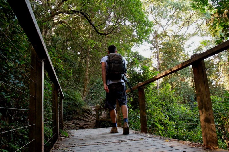
This is one of Lake Macquarie’s classic walking trails, kicking off from a car park in Kahibah with a boardwalk above Glenrock State Conservation Area’s forest floor, and ending in the sand of Glenrock Lagoon and a wonderfully secluded beach. If you’re feeling adventurous (and the tides are low) you can even walk all the way around the point to Merewether Ocean Baths!
Start Point: Carpark (Burwood Rd, Kahibah)
Length: 6.8km (return)
Swansea Bridge to Pirrata Island
Head south and enjoy the beautiful waterways of Lake Macquarie. Park the car near Swansea’s Swim Centre and start walking along the path towards Pirrata Island. Make your way through the carpark at Swansea boat ramp before turning right over the wooden bridge towards Pirrata Island. Feeling adventurous? Keep following the path before you make your way out to the point where you’ll be greeted with beautiful views looking over to the other side of the lake.
Start Point: Channel St, Swansea
Length: 2.5km (one-way)
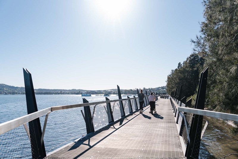
Warners Bay to Speers Point
The mostly flat track from Eleebana Boat Ramp to Speers Point Park is popular among Lake Macquarie locals. Walk on water as your take on the 360m over-water Red Bluff Walkway before making your way towards Warners Bay Foreshore. Take in the public art installations and try the outdoor fitness equipment. Keep on keeping on as your make your way around ‘stinky corner’ and towards Speers Point Park.
Start Point: Eleebana Boat Ramp
Length: 5.6km (one-way)
Ken & Audrey Owens Walk
Head to Redhead and wander 4km of pathways, boardwalks, bridges, and surf observation platforms. The easy walk is great for the whole family and makes for a good few hours spent out of the house.
Start Point: Cain St, Redhead
Length: 4km (one-way)
Cooranbong Swing Bridge & Sandy Creek Walk
Hidden at the back of the old Sanitarium factory is the iconic Cooranbong Swing Bridge. The well-kept secret is a little tricky to find at first, but well-worth it.
Start Point: Victory St, Cooranbong
Length: 3km (return)
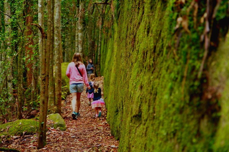
Boarding House Dam
On the doorstep of Lake Macquarie, Watagans National Park boasts some of the best rainforest scenery in NSW. Explore one of the prettiest spots, Boarding House Dam; a picturesque former logging camp. The starting point takes you on the 700m circuit walk through a storybook forest of impossibly green trees, shrubs, and moss-covered rocks and logs.
Start Point: Watagans National Park
Length: 700m (circuit)
The Green Point Circuit Walk
Showcasing all of the best locations across Green Point Reserve, this walk takes in Sea Eagle Park, Green Point, and viewpoints of the foreshore. The mostly flat walk is another great one to get the whole family out and about.
Start Point: Shores Way, Green Point
Length: 7.7km (circuit)
Kilaben Nature Walk
Kicking off at Toronto Fire Station, this walk takes you down a fire trail before linking to the elevated boardwalks through to Kilaben Bay.
Start Point: Kilaben Rd, Kilaben Bay
Length: 1.5km (one-way)
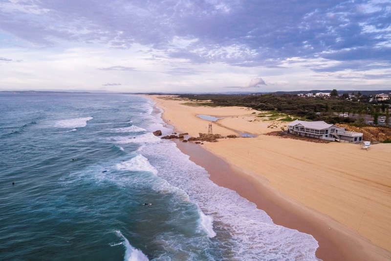
Nine Mile Beach
Known at Nine Mile Beach, the stretch between Redhead to Blacksmiths Beach only actually covers seven! Tackle the sandy walk and take in coastal lagoons, rarely frequented stretch of dunes, wetlands, and oceans teeming with fish and other marine life.
Start Point: Redhead Beach
Length: 10.4km (one-way)
Mount Sugarloaf Northern Track
Park the car at the Mount Sugarloaf carpark, right where a number of hiking tracks start. This particular walk will take you away from the summit, to visit a quieter viewpoint.
Start Point: Mount Sugarloaf Carpark
Length: 3.8km (circuit)
Newcastle
Hickson St Track
Known as a hang gliding take-off spot and a favourite for picnickers, Hickson St lookout is also the starting point for a walk down to Burwood Beach. Whilst the decline is rather easy, be prepared for the steep short walk back up!
Start Point: Hickson St, Merewether
Length: 500m (one-way)
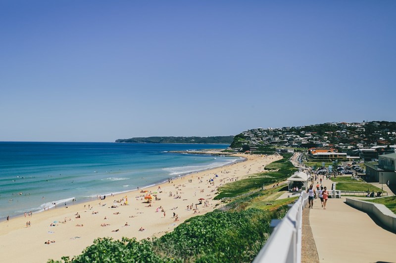
Merewether Baths to Anzac Memorial Walk
The much-loved Bather’s Way walk takes in some of Newcastle’s most iconic views. From Merewether Ocean Baths, past Merewether Beach, Dixon Park Beach, and Bar Beach up towards the winding staircase that leads to the Anzac Memorial Walk; this walk is probably Newcastle’s most scenic (and most popular).
Start Point: Merewether Ocean Baths
Length: 3km (one-way)
Strzelecki Lookout to Nobbys Beach
Still got some energy? Keep on walking and making your way down through King Edward Park and enjoy the other side of Newcastle. Overlook the harbour and the city as you make your way towards Newcastle Beach, past Newcastle Ocean Baths, and towards Nobbys.
Start Point: Strzelecki Lookout
Length: 3km (one-way)
Nobbys Beach – Newcastle Breakwall – Wickham
If you’re keen to REALLY get your hike on, just keep on walking once you reach Nobby’s Beach out onto the Newcastle Breakwall before turning around and heading right towards Honeysuckle. With the city on your left and the harbour on your right, the flat walk is perfect for picking up that pace as you creep towards Wickham. Make it to the end? Treat yourself to a meal and a good coffee at Wickham Boatshed!
Start Point: Nobbys Beach
Length: 4km (one-way)
Scotts Point Walk
Leading you through the heart of Hunter Wetlands National Park, the 2km track allows you to explore the area that's rich in history and nature. Wander down the boardwalk as you keep an eye out for the array of birds in the area. Make sure to pack a picnic because once you reach the end, you can set up at the well-established Riverside picnic area on the banks of the Hunter River.
Start Point: Carpark (Scotts Way, Kooragang)
Length: 2km (one-way)
Shipwreck Walk
Live on the other side of Newcastle? Get those feet moving and see Newcastle from a different perspective as you make the 2km walk along Stockton’s breakwall or as the locals call it ‘Shipwreck Walk’.
Start Point: King St, Stockton
Length: 2km (one-way)
Fernleigh Track
The mighty popular walking and cycling track that connects Newcastle and Lake Macquarie is one of our area’s coolest tracks. The peaceful and scenic track takes you right past residential communities and through stunning bushland with nods to the track's past, including old railways and of course the Fernleigh tunnel!
Start Point: Belmont (Railway Pde) or Adamstown (Train Station)
Length: 15km (one-way)
Blackbutt Circuit Walk
You might know Blackbutt Reserve for its cute animals and family-friendly picnic spots, but there's plenty of beautiful walks to do in the reserve too. Try the Blackbutt Circuit Walk, which gives you the feeling of being deep in the bush, despite being not far from sububia.
Start Point: Richley Reserve Car Park
Length: 6.5km (circuit)
Do you think we've missed somewhere? Email us!


